.png)
Thursday, September 25, 2014
Tuesday, September 23, 2014
Blog 3
http://www.wpmap.org/wp-content/uploads/2012/04/greece-map1.gif
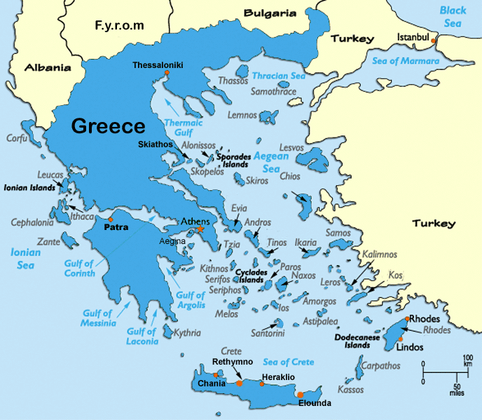
This map shows how text can create the focal point of a map. Even though Greece is one of the smaller countries in Europe, the large font size of the word "Greece" draws focus to the most important country on this particular map. The font size, shading and boldness of the surrounding Greek islands' names also raises the level of the Greece's visual significance in comparison to the other countries.
This map shows how text can create the focal point of a map. Even though Greece is one of the smaller countries in Europe, the large font size of the word "Greece" draws focus to the most important country on this particular map. The font size, shading and boldness of the surrounding Greek islands' names also raises the level of the Greece's visual significance in comparison to the other countries.
Week 2 blog
http://www.wired.com/images_blogs/wiredscience/2013/11/Lambert_conformal_conic_projection_SW.jpg

This Conformal Conic projection shows the Earth from an interesting perspective. Looking down from the north pole allows the viewer to see the amount of land that is concentrated exclusively in the northern hemisphere. It is crazy to think that 90 percent of the world's population is located in this limited space above the equator.
This Conformal Conic projection shows the Earth from an interesting perspective. Looking down from the north pole allows the viewer to see the amount of land that is concentrated exclusively in the northern hemisphere. It is crazy to think that 90 percent of the world's population is located in this limited space above the equator.
Thursday, September 18, 2014

Wednesday, September 10, 2014

Monday, September 8, 2014
Post 1: Static Map

This is a map depicting the path of Route 1 or "Pacific Coast Highway" in California. Growing up in Long Beach, my dad and I would take trips to different beaches along the southern part of the state. On the occasional Friday, he would pick me up from school -car packed- and we would head off for the weekend. On those trips, the travelling was as beautiful as the destination. For hours we would parallel the coast as his 1970 VW bug slowly twisted and turned down the old highway to San Onofre, San Clemente or even San Diego.
As a kid I travelled the same stretch of Route 1 from Long Beach to Mexico countless times. But if I make it back to California, it is my goal to drive from the top of the state all the way to the bottom. It would be the trip of a lifetime surrounded by beauty, beaches and nostalgia.
Subscribe to:
Comments (Atom)